
Digital Mapping and Geographic Information Systems (GIS)
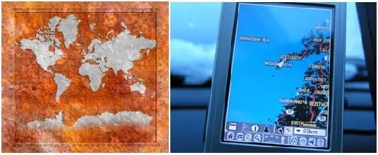 Maps visualize and indicate desired locations.Copyright Both photos are public domain from Stock XCHNG
This unit is divided into two main thrusts. Part 1 addresses GIS in general. This topic is covered most heavily in Lesson 1, "What is GIS?" and Lesson 2, "Projections and Coordinates: Turning a 3D Earth into Flatlands." Additionally, Activity 1, "Who Can Make the Best Coordinate System?," Activity 2, "What's Wrong with the Coordinates at the North Pole?," and Activity 4, "Searching for Bigfoot and Others Lke Him" help supplement this first part of the unit.
Part 2 of the unit includes Lesson 3, "The Great Pacific Garbage Patch," and Activity 3, "Plastic in the Ocean: Get the Word Out at McDonalds!," Activity 5, "Where Are the Plastics Near Me? (Field Trip)" and Activity 6, "Where Are the Plastics Near Me? (Mapping the Data)." These focus more on using GIS for a particular application: the study and representation of data related to the Great Pacific Garbage Patch.
If the teacher wishes to simply give students exposure to GIS and digital mapping concepts, then use all or some of Lessons 1-2 and Activities 1-2, 4 without reference to any of the environmental concerns of the other half of the unit.
If, however, the teacher is more interested in the environmental side of the unit and less in the GIS aspects, then all or parts of Lesson 3 and Activities 3 and 5 go far in exposing students to an environmental issue that relates to their own community. Following this more environmental approach, students are asked to understand scientific information that they find on their own, evaluate its usefulness, and give credit to its source.
Activity 6 is the exercise that puts together both what students are expected to learn from the GIS side of the unit and the solid waste environmental side.
GIS is a tool used in many different engineering disciplines, including environmental, petroleum, ocean and civil. GIS often involves looking at large datasets to draw conclusions from spatial patterns. And GIS is essential in planning of engineering projects. Nearly any engineering that is in some way connected with field-based projects used GIS in some way.
- MS-ESS3-4 Construct an argument supported by evidence for how increases in human population and per-capita consumption of natural resources impact Earth's systems.
Grades 6-8
This resource focuses on the following Three Dimensional Learning aspects of NGSS:
Science & Engineering Practices- Construct an oral and written argument supported by empirical evidence and scientific reasoning to support or refute an explanation or a model for a phenomenon or a solution to a problem.Do you agree with this alignment?
Disciplinary Core Ideas- Typically as human populations and per-capita consumption of natural resources increase, so do the negative impacts on Earth unless the activities and technologies involved are engineered otherwise.Do you agree with this alignment?
Crosscutting Concepts- Cause and effect relationships may be used to predict phenomena in natural or designed systems.Do you agree with this alignment?
- Scientific knowledge can describe the consequences of actions but does not necessarily prescribe the decisions that society takes.Do you agree with this alignment?
- All human activity draws on natural resources and has both short and long-term consequences, positive as well as negative, for the health of people and the natural environment.Do you agree with this alignment?
Do you agree with this alignment? - Construct an oral and written argument supported by empirical evidence and scientific reasoning to support or refute an explanation or a model for a phenomenon or a solution to a problem.
- Day 1: What Is GIS? lesson
- Day 2: Projections and Coordinates: Turning a 3D Earth into Flatlands lesson
- Day 3: Who Can Make the Best Coordinate System? activity
- Day 3-4: What's Wrong with the Coordinates at the North Pole? activity
- Day 5-7: Searching for Bigfoot and Others Like Him activity
- Day 8: The Great Pacific Garbage Patch lesson
- Day 9-11: Plastic in the Ocean: Get the Word Out at McDonalds! activity
- Day 12-14: Where Are the Plastics Near Me? (Field Trip) activity
- Day 15-17: Where Are the Plastics Near Me? (Mapping the Data) activity
- Digital Mapping and Geographic Information Systems (GIS)
Contributors
Nathan Howell; Andrey Koptelov
Supporting Program
National Science Foundation GK-12 and Research Experience for Teachers (RET) Programs, University of Houston
Acknowledgements
This digital library content was developed by the University of Houston's College of Engineering under National Science Foundation GK-12 grant number DGE-0840889. However, these contents do not necessarily represent the policies of the NSF and you should not assume endorsement by the federal government.
Copyright
2013 by Regents of the University of Colorado; original © 2010 University of Houston