
Identifying Possible Underground Cavern Locations
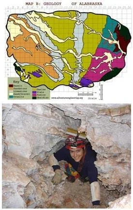 Students work with scales and maps.Copyright (map) Adventure Engineering, Colorado School of Mines, and (cave photo) National Park Service
http://www.nps.gov/wica/photosmultimedia/Cave-Photos.htm
Students work with scales and maps.Copyright (map) Adventure Engineering, Colorado School of Mines, and (cave photo) National Park Service
http://www.nps.gov/wica/photosmultimedia/Cave-Photos.htm
Continuing the Asteroid Impact challenge, students use their knowledge of scales and areas to determine the best locations in Alabraska for the underground caverns. They cut out rectangular paper pieces to represent caverns to scale with the maps. They place the paper cutouts on the maps to determine feasible locations. This is activity 4 of the Asteroid Impact curricular unit and builds on the previous activities in the the unit.
Engineers usually propose multiple solutions to problems, and then analyze each solution before selecting the one that best meets the criteria for success.
After this activity, students should be able to:
- Explain that the same area can be represented by various shapes.
- Determine the length and width of a rectangle when given the area of a rectangle.
- Apply the map scale to create a cavern area.
- Synthesize multiple pieces of information and make a decision based on all the information.
- 6.1.2.b Fluently add, subtract, multiply, and divide multidigit decimals using standard algorithms for each operation.
Grade 6
Do you agree with this alignment? - 8.4.2.d State the formulas for the volumes of cones, cylinders, and spheres and use them to solve real-world and mathematical problems.
Grade 8
Do you agree with this alignment? - 7.4.2.d Solve real-world and mathematical problems involving area, volume and surface area of two- and three-dimensional objects composed of triangles, quadrilaterals, polygons, cubes, and right prisms.
Grade 7
Do you agree with this alignment?
- Analyze and interpret data identifying ways Earth's surface is constantly changing through a variety of processes and forces such as plate tectonics, erosion, deposition, solar influences, climate, and human activity
Grade 5
Do you agree with this alignment? - Develop and communicate an evidence based scientific explanation around one or more factors that change Earth's surface
Grade 5
Do you agree with this alignment? - Gather, analyze, and communicate data that explains Earth's plates, plate motions, and the results of plate motions
Grade 7
Do you agree with this alignment?
- CCSS.Math.Content.6.NS.B.3 Fluently add, subtract, multiply, and divide multi-digit decimals using the standard algorithm for each operation.
Grade 6
Do you agree with this alignment? - CCSS.Math.Content.7.G.B.6 Solve real-world and mathematical problems involving area, volume and surface area of two- and three-dimensional objects composed of triangles, quadrilaterals, polygons, cubes, and right prisms.
Grade 7
Do you agree with this alignment? - CCSS.Math.Content.8.G.C.9 Know the formulas for the volumes of cones, cylinders, and spheres and use them to solve real-world and mathematical problems.
Grade 8
Do you agree with this alignment?
- Requirements for design are made up of criteria and constraints.
Grades 6-8
Do you agree with this alignment? - Make two-dimensional and three-dimensional representations of the designed solution.
Grades 6-8
Do you agree with this alignment? - STEL-7J Evaluate designs based on criteria, constraints, and standards.
Grades 3-5
Do you agree with this alignment?
- MS-ESS2-2 Construct an explanation based on evidence for how geoscience processes have changed Earth's surface at varying time and spatial scales.
Grades 6-8
This resource focuses on the following Three Dimensional Learning aspects of NGSS:
Science & Engineering Practices- Construct a scientific explanation based on valid and reliable evidence obtained from sources (including the students' own experiments) and the assumption that theories and laws that describe the natural world operate today as they did in the past and will continue to do so in the future.Do you agree with this alignment?
Disciplinary Core Ideas- The planet's systems interact over scales that range from microscopic to global in size, and they operate over fractions of a second to billions of years. These interactions have shaped Earth's history and will determine its future.Do you agree with this alignment?
- Water's movements—both on the land and underground—cause weathering and erosion, which change the land's surface features and create underground formations.Do you agree with this alignment?
Crosscutting Concepts- Time, space, and energy phenomena can be observed at various scales using models to study systems that are too large or too small.Do you agree with this alignment?
Do you agree with this alignment? - Construct a scientific explanation based on valid and reliable evidence obtained from sources (including the students' own experiments) and the assumption that theories and laws that describe the natural world operate today as they did in the past and will continue to do so in the future.
- MS-ETS1-1 Define the criteria and constraints of a design problem with sufficient precision to ensure a successful solution, taking into account relevant scientific principles and potential impacts on people and the natural environment that may limit possible solutions.
Grades 6-8
This resource focuses on the following Three Dimensional Learning aspects of NGSS:
Science & Engineering Practices- Define a design problem that can be solved through the development of an object, tool, process or system and includes multiple criteria and constraints, including scientific knowledge that may limit possible solutions.Do you agree with this alignment?
Disciplinary Core Ideas- The more precisely a design task's criteria and constraints can be defined, the more likely it is that the designed solution will be successful. Specification of constraints includes consideration of scientific principles and other relevant knowledge that is likely to limit possible solutions.Do you agree with this alignment?
Crosscutting Concepts- The uses of technologies and any limitations on their use are driven by individual or societal needs, desires, and values; by the findings of scientific research; and by differences in such factors as climate, natural resources, and economic conditions.Do you agree with this alignment?
- All human activity draws on natural resources and has both short and long-term consequences, positive as well as negative, for the health of people and the natural environment.Do you agree with this alignment?
Do you agree with this alignment? - Define a design problem that can be solved through the development of an object, tool, process or system and includes multiple criteria and constraints, including scientific knowledge that may limit possible solutions.
- paper
- scissors
- rulers
- calculators
- 3 handouts: Possible Locations Worksheet (PDF), Alabraska General Map (PDF), Alabraska Geology Map (PDF)
Understanding of length, width and area; ability to read a map.
Today, your engineering team's task is to identify your best possible locations in Alabraska to locate your caverns. As you do this, you will get a lot of practice thinking about length, width and area!
First, figure out the shape and dimensions of the cavern you imagine, making sure to size it to provide enough shelter space. Then, make rectangular paper pieces that represent the caverns—to scale—which you can place on the Alabraska map to find three possible locations.
Let's get going!
Background
As necessary, refresh students' knowledge on how to use map scales.
Before the Activity
Gather materials and make copies of the worksheet.
With the Students
- Hand out the materials to each group.
- This activity builds upon of the relationship between length, width and area. As necessary, review how to calculate area when given a length and a width AND how to calculate possible combinations of length and width when given an area.
Tip: Draw various rectangular shapes on the board (with dimensions) and ask the class to come up with other possible combinations of equal areas.
- It is important to spend some time discussing possible shape combinations to match the total area of the cavern. It is okay if some teams want long skinny caverns and others envision square caverns. Some creative groups may choose triangular caverns or circular caverns. The key is that each shape must provide the necessary area.
Tip: After completing worksheet question 3, have each group show the class its proposed cavern shapes—its cutout piece(s) of paper.
- To complete question 4, student teams must synthesize all the information they have gathered thus far and propose three locations. As needed, provide assistance and prompts.
- Have teams share their identified locations with the class and explain why they chose those locations.
Worksheet: Review students' answers on the Possible Locations Worksheet (PDF) to gauge their comprehension of the material and concepts covered. Refer to the Asteroid Impact Student Workbook Example Answers provided in the unit document for example worksheet answers.
Have students compare the sizes of different U.S. states or different countries in the world.
- Adventure Engineering Challenge: Asteroid Impact
- Incoming Asteroid! What's the Problem?
- How Big? Necessary Area & Volume for Shelter
- Using Map Scales to Figure Distances and Areas
- Identifying Possible Underground Cavern Locations
- Rocks, Rocks, Rocks: Test, Identify Properties & Classify
- Ranking the Rocks for Desired Properties
- Recommendations & Presentations: Drum Roll Please
- Building & Testing Model Underground Safety Caverns
Supporting Program
Adventure Engineering, Colorado School of Mines
Acknowledgements
Adventure Engineering was supported by National Science Foundation grant nos. DUE 9950660 and GK-12 0086457. However, these contents do not necessarily represent the policies of the National Science Foundation, and you should not assume endorsement by the federal government.
Copyright
2013 by Regents of the University of Colorado; original © 2005 Colorado School of Mines