
Quick Look
Grade Level: 4 (3-5)
Time Required: 45 minutes
Expendable Cost/Group: US $0.50
Group Size: 2
Activity Dependency: None
Associated Informal Learning Activity: Can You Catch the Water?
Subject Areas: Earth and Space
NGSS Performance Expectations:

| 5-ESS2-1 |
Quick Look
- Grade Level:
- 4 (3 – 5)
- Time Required:
- 45 minutes
- Group Size:
- 2
- Associated Informal Learning Activity:
Associated Informal Learning Activity indicates that an abbreviated version of this activity is available. These 60-minutes-or-less, easy-to-prep “taste of engineering” activities are intended for informal learning settings.
- Can You Catch the Water?
- Subject Areas:
-
Earth and Space -
NGSS Performance Expectations:
5-ESS2-1
Summary
Students construct three-dimensional models of water catchment basins using everyday objects to form hills, mountains, valleys and water sources. They experiment to see where rain travels and collects, and survey water pathways to see how they can be altered by natural and human activities. Students discuss how engineers design structures that impact water collection, as well as systems that clean and distribute water.
Engineering Connection
Catchment basins and watersheds are important to most living things, since water flow, direction and location are vital to water availability for everyday life. Environmental, chemical and civil engineers, along with geologists and hydrologists are all interested in catchment basins, how they change, and how water flows through them. Recently, in the Earth's geologic timeline, we are seeing catchment basins changing in response to human water diversion and water collection activities. How human-made technologies affect our water sources, water quality and watersheds is of great importance to protect the people, industries and wildlife that depend upon a working system of clean water for survival.
Learning Objectives
After this activity, students should be able to:
- Define and describe a catchment basin.
- Define and describe a watershed.
- Relate their model basin to real-world water flow patterns.
- Explain engineers' involvement with watersheds and catchment basins.
- Describe how some of the Earth's systems interact (hydrosphere, atmosphere and geosphere).
Educational Standards
Each Teach Engineering lesson or activity is correlated to one or more K-12 science,
technology, engineering or math (STEM) educational standards.
All 100,000+ K-12 STEM standards covered in Teach Engineering are collected, maintained and packaged by the Achievement Standards Network (ASN),
a project of D2L (www.achievementstandards.org).
In the ASN, standards are hierarchically structured: first by source; e.g., by state; within source by type; e.g., science or mathematics;
within type by subtype, then by grade, etc.
Each Teach Engineering lesson or activity is correlated to one or more K-12 science, technology, engineering or math (STEM) educational standards.
All 100,000+ K-12 STEM standards covered in Teach Engineering are collected, maintained and packaged by the Achievement Standards Network (ASN), a project of D2L (www.achievementstandards.org).
In the ASN, standards are hierarchically structured: first by source; e.g., by state; within source by type; e.g., science or mathematics; within type by subtype, then by grade, etc.
NGSS: Next Generation Science Standards - Science
| NGSS Performance Expectation | ||
|---|---|---|
|
5-ESS2-1. Develop a model using an example to describe ways the geosphere, biosphere, hydrosphere, and/or atmosphere interact. (Grade 5) Do you agree with this alignment? |
||
| Click to view other curriculum aligned to this Performance Expectation | ||
| This activity focuses on the following Three Dimensional Learning aspects of NGSS: | ||
| Science & Engineering Practices | Disciplinary Core Ideas | Crosscutting Concepts |
| Develop a model using an example to describe a scientific principle. Alignment agreement: | Earth's major systems are the geosphere (solid and molten rock, soil, and sediments), the hydrosphere (water and ice), the atmosphere (air), and the biosphere (living things, including humans). These systems interact in multiple ways to affect Earth's surface materials and processes. The ocean supports a variety of ecosystems and organisms, shapes landforms, and influences climate. Winds and clouds in the atmosphere interact with the landforms to determine patterns of weather. Alignment agreement: | A system can be described in terms of its components and their interactions. Alignment agreement: |
International Technology and Engineering Educators Association - Technology
-
The use of technology affects the environment in good and bad ways.
(Grades
3 -
5)
More Details
Do you agree with this alignment?
-
Models are used to communicate and test design ideas and processes.
(Grades
3 -
5)
More Details
Do you agree with this alignment?
State Standards
Colorado - Science
-
Create and evaluate models of the flow of nonliving components or resources through an ecosystem
(Grade
4)
More Details
Do you agree with this alignment?
Materials List
For the Introduction/Motivation activity, each student needs:
- 1 blank note card
- pencil or pen
For the activity, each group needs the following (or similar) items:
- a variety of objects to build land-forms, such as small cups, jars, bowls, plates, rocks, blocks, crunched paper towels, etc.
- sheet of light-weight plastic, ~1 x 1 meter (a slit-open trash bag works well)
- (optional) spray bottle filled with water, to deliver "rain" to the catchment basin
- (optional) masking tape, to hold items in place, to secure the plastic sheet
- (optional) newspaper
- sponge
- a few drops of food coloring
- Catching Water Worksheet, one per student
Worksheets and Attachments
Visit [www.teachengineering.org/activities/view/cub_earth_lesson2_activity3] to print or download.Introduction/Motivation
(Hand out blank notecards, one per student.) On your notecard, write down everything you can think of that would affect a stream or a river of water, and everything that you know about streams or rivers. I'll give you three minutes.
(Three minutes later, bring the class back together.) Raise your hands if you wrote on your notecard any of the following items or things that fit into these categories (write them on the board as they are discussed):
- Water quality (dirt, pollution, contamination, industrial waste, spills, etc.): Water and ice make up one of the Earth's systems called the hydrosphere, which we'll focus on in this activity.
- Precipitation (climate, weather, rain, snow, dry, etc.): Precipitation forms in the atmosphere and falls to the Earth to enter the hydrosphere.
- Location (landforms, mountains, plains, valleys, hills, etc.): Landforms on the Earth are part of the geosphere, which includes solid and molten rock, soil and sediments.
- Life (animal life, plant life, human activities, soil, etc.): Animals, humans and plants all make up the biosphere.
- Human impact (dams, diversions, buildings, factories, water collection, canals, levees etc.)
What else did you write on your cards that we have not talked about yet? (Write these items on the board, also.)
All of the things we just listed and discussed affect our water sources, which make up the hydrosphere, along with snow and ice. These are factors that can determine whether a source of water is clean enough for us to use for bathing or drinking. Have you ever looked carefully at the water in a stream or river? Did it look clean or muddy? Many things can affect the water in a river or stream. Sometimes the water looks really clean, but it really is not because of invisible pollutants or tiny bugs that live in the water. How can we tell if the water is clean?
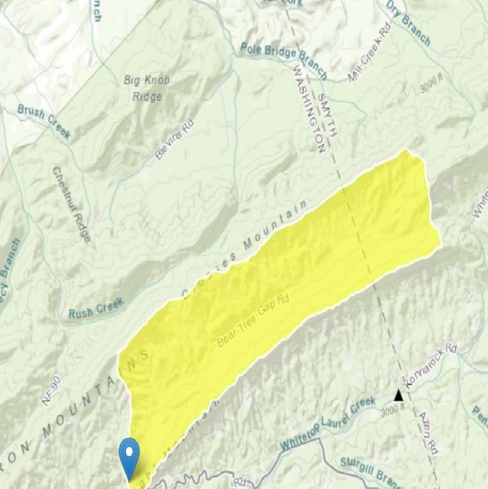
Well, first let's figure out from where this water comes and how it gets to a specific stream or river. The entire area from where stream or river water begins to where it finally reaches you is called a catchment basin (or a river basin or water basin; see Figure 1). The boundary between a catchment basin and the one next to it is called a watershed. A watershed is also the area of land that drains all the small streams and rainfall to a common place such as the mouth of a bay or any point along a large stream or river. Water moves between basins, watersheds, the atmosphere and back again through what we call the water cycle. Often, the terms watershed and catchment basin are used interchangeably.
.")
What directs the flow of water though a watershed or catchment basin? Why does it go one way and not the other? How do different catchment basins and watersheds develop? Well, a lot of water flow is directed through rivers and streams by gravity. Today, we are going to figure out why different catchment basins and watersheds happen and how much of that depends on gravity.
Engineers often create models when they are trying to learn about how something works. To help communities get usable water for their citizens, engineers often create models of watersheds or catchment basins to help them experiment and figure out how to move the water to a new area without hurting the land. Then, engineers develop technologies to help us clean up the water so we can use it for drinking and all sorts of other uses. Today, we are going to model our own catchment basins so we can figure out what happens to water when it falls onto different types of landforms, where it goes, and what factors might affect it. This will help us understand how engineers can move water from one watershed to the next.
Procedure
Before the Activity
- Gather materials and make copies of the Catching Water Worksheet.
- Find a flat space for each group to work that is at least 1.5 x 1.5 meters in size. Make sure it is an area that can get wet. Outside or on a floor or tabletop works well.
- To absorb excess water, consider placing newspaper or large plastic sheets on the flat, model-building space.
- Fill spray bottles with water; if no spray bottles are available, use fingers to sprinkle water.
With the Students: Part 1: Building
- Divide the class into teams of two students each. Provide each team with a work area and materials, including worksheets.
- Inform the teams that they will first design their own models of an area of land using the provided materials. The land form can look any way they want.
- Have students position their objects (cups, bowls, jars, rocks, plates, paper towels) anywhere on the space; the tallest objects represent mountains, the other objects represent hills, lakes and plains (see Figure 2). Suggest that they arrange objects to create valleys and low spots.

- Next, have students lay the plastic sheet over the top of their entire area (land), including all of the land-form objects. Have them loosely mold the plastic around the covered objects (see Figure 3). As needed, use masking tape to secure the positions of the objects and the plastic.

- On their worksheets, have students write down their predictions about what will happen if it rains on their models. Where will the water go? Will it go faster in some places? Why?
With the Students: Part 2: Raining and Modeling
- Have students use the spray bottle (or sprinkle water with their fingers) to create rain on top of the highest mountain (the tallest object). Point out that this represents precipitation, which is part of the water cycle. Precipitation can come in the form of rain or snow or sleet. Continue the rain until streams, rivers and lakes form. Suggest that they watch for how the water moves from the mountaintop down into the model.
- Have students choose one small pool or puddle of water on their models to be the water collection designated site for the people who live on this land.
- Using the model, define catchment basin and watershed. Explain that the places where the water goes, where it hits, where it flows, are all in the catchment basin for that site. The watershed is the basin boundary or edge of the plastic wrap.
- Have students answer the next worksheet questions:
- From where does the water that flows to their water collection site come? (Answer: Rain.)
- What things on the landscape determine what will be part of your basin? (Answer: Any land-forms, hills, lakes, etc.)
- What determines the watershed? (Answer: Where the next watershed starts. In this case, the edge of the basin or plastic wrap.)
- How does the water flow? What things in your model determine the direction of water flow? (Introduce the idea of topography and have students explain or draw arrows on their basin to show the direction of water flow. See the Activity Extensions section for more on topography mapping.)
- Guide students to conduct the following experiments within their catchment basin to simulate real-life natural and human-caused activities that could happen in a catchment basin and/or watershed.
- What happens if a dam is put into the stream that flows into your catchment basin? (Using a sponge, create a dam across the first stream of water. Use the spray bottle to make it rain again. How does the flow of water change? Remove sponge.)
- What happens if a forest is planted above the catchment basin? (Place the sponge for the forest on the side of the highest hill. Use the spray bottle to make it rain again. How does the flow of water change? Remove sponge.)
- What happens if we build an industry or factory that generates pollution? (Place a few drops of food coloring on the sponge and place this where the industry might be located. Use the spray bottle to make it rain again. How does the water change? Remove sponge.)
- What happens when people use the water from your stream that flows into your catchment basin for irrigating their crops or to take to another city? (Make "canals" by making a wrinkle in the plastic to divert water to other places. Use the spray bottle to make it rain again. How does the flow of water change?)
- Give students time to answer the worksheet questions. Conclude by holding a class discussion to share and compare results. Ask the post-activity closing discussion assessment questions as described in the Assessment section.
Vocabulary/Definitions
atmosphere: One of the Earth's systems that includes the layer of air, water vapor and other gases surrounding the Earth.
basin: An open, enclosed area that usually holds water.
biosphere: One of the Earth's systems that includes all living things.
catchment basin: The geographical area draining into a river or reservoir; sometimes called a river basin or water basin; where your water comes from.
climate: The meteorological conditions (weather), including temperature, precipitation and wind that characteristically prevail in a particular region.
geosphere: One of the Earth's systems that includes solid and molten rock, soil and sediments.
gravity: The downward pull of a planet that determines the flow of water.
hydrosphere: One of the Earth's systems tha includes water and ice.
landform: Natural part of the Earth and land such as a mountain, hill, valley, plain, river and stream.
model: A small object that represents another, often larger object; sometimes used in testing or refining a final design, plan or product.
precipitation: Any form of water (rain, snow, sleet or hail) that falls to the Earth's surface.
season: A Natural division of the year (spring, summer, fall and winter) in the north and south temperate zones; each season, beginning astronomically at an equinox or solstice, is characterized by specific meteorological or climatic conditions; two divisions of the year (rainy and dry) in some tropical regions.
topography: The surface features of a place or region on a map that shows landform locations and elevations.
water cycle: How water circulates through the atmosphere; the cycle of evaporation and condensation that controls the distribution of the earth's water as it evaporates from bodies of water, condenses, precipitates and returns to those bodies of water.
water quality: Water characteristics that determine its suitability for various uses.
watershed: The region draining into a river, river system or other body of water; also, a ridge of high land (a boundary) dividing two (catchment basin) areas that are drained by different river systems.
Assessment
Pre-Activity Assessment
Catchment Basin/Watershed Bingo: Give each student a sheet of paper on which to draw a large tic-tac-toe board—a 3 x 3 grid with nine squares—that fills the entire paper. Have students randomly write the following vocabulary words, one per square (see Figure 4): basin, catchment basin, gravity, land forms, model, topography, water cycle, water quality, and watershed. Note: Direct students to write the terms in any square they want, which creates a variety of bingo boards. Next, have students walk around the room and find other students who can define the vocabulary terms and write down their definitions. Students must find a different student for each word. When a student has all terms defined, s/he shouts "bingo!" Continue until two or three students have bingo. Ask the students who shout "bingo!" to share their definitions with the class.

Bingo Modification: Alternatively, have the teacher read the definitions aloud to the class, and each student place an "X" through the correct word on his/her bingo board until someone has three in a row—a "bingo!"
Activity Embedded Assessment
Worksheet: Have students answer the questions on the Catching Water Worksheet. Review their answers to gauge their mastery of the subject.
Post-Activity Assessment
Closing Discussion: Lead a class discussion by asking the following questions and posing the following scenarios to the students in their groups:
- What factors affected where the rain flowed in our catchment basins?
- What would happen to the water in the valley if you poured a pile of salt on the mountain above your catchment basin? (This might represent mining, mineral and chemical waste.)
- What are three things that might happen to your catchment basin that would affect water quality?
- If the community in a watershed near yours needed some drinking water, how could an engineer help move some of your water to share with the other watershed?
- How might the flow of water in a catchment basin be different in different seasons?
- How might the flow of water in a catchment basin be different in different climates?
- What kinds of human activities might affect the catchment basin?
- How might engineers help clean up the industry pollution to a catchment basin?
Troubleshooting Tips
Make sure students set up their objects in a way that allows for a good flow of water.
Adding heavy rain and pollutants can cause excessive drainage to the area outside of the model basin. Make sure to have enough measures in place to keep the area relatively clean or to mop up the excess water. To keep it really neat, have student groups create their "land" in large, flat, plastic tubs or cardboard boxes so water is contained as it rolls off the plastic sheets.
Activity Extensions
Introduce the concepts of topographic mapping in a hands-on way by having students follow the steps below, using their catchment basin models. This activity requires a ruler, marker, tape (optional), paper and pencil for each team:
- Use a permanent marker (or tape) to mark points on the model that are 10 cm above the surface of the ground/floor/table where the model is placed.
- Using a marker, connect all of these points to make a ring around the model. The resulting ring represents a 10-cm contour line.
- Measure points 20 cm above the surface, and use a marker to connect these points. This ring represents a 20-cm contour line.
- Continue this for 30, 40 and 50 cm, up to the tallest point on the model.
- Looking at the model and rings from above, what do you notice? Are the rings concentric—meaning are the higher rings inside the lower rings (Answer: Yes)
- Draw the rings from the model on a piece of paper as if you were seeing them from above. This creates a topographic map of the catchment basin / watershed.
Activity Scaling
- For lower grades, conduct the activity as a class demonstration.
- For upper grades, extend the use of the catchment basin model by introducing the concept of topography, as described in the Activity Extensions section.
Subscribe
Get the inside scoop on all things Teach Engineering such as new site features, curriculum updates, video releases, and more by signing up for our newsletter!More Curriculum Like This

Students model a water catchment basin and survey water pathways to understand factors that affect water flow.

Understanding watersheds can help engineers design systems that deliver or protect key sources of water. In this activity, students become civil engineers as they use topographic maps to delineate watersheds. Watersheds show the path water travels over land in a particular area on its way to a river...
Students learn about the water cycle and its key components. They learn how we can use the theory of conservation of mass to estimate the amount of water that enters a watershed (precipitation, groundwater flowing in) and exits a watershed (evaporation, runoff, groundwater out).

Students learn about floods, discovering that different types of floods occur from different water sources, but primarily from heavy rainfall. Students learn what makes floods dangerous and what engineers design to predict, control and survive floods.

References
Dictionary.com. Lexico Publishing Group, LLC. Accessed September 29, 2020. (Source of some vocabulary definitions, with some adaptation) http://www.dictionary.com
Model a Catchment Basin Learning Activity 3. 2005. Hydrology, The Globe Program (http://www.globe.gov), University Corporation for Atmospheric Research, Colorado State University. Accessed September 29, 2020. (Source of activity, modified) https://www.globe.gov/documents/11865/0e15aa76-355e-4be5-afb1-a8f81cd30bff
Watershed Information Network. Last updated February 22, 2006. U.S. Environmental Protection Agency. Accessed March 15, 2006. Originally found at: http://www.epa.gov/owow/watershed/
Copyright
© 2006 by Regents of the University of ColoradoContributors
Jay Shah; Malinda Schaefer Zarske; Denise W. Carlson; Janet YowellSupporting Program
Integrated Teaching and Learning Program, College of Engineering, University of Colorado BoulderAcknowledgements
The contents of these digital library curricula were developed by the Integrated Teaching and Learning Program under National Science Foundation GK-12 grant no. 0338326. However, these contents do not necessarily represent the policies of the NSF, and you should not assume endorsement by the federal government.
Last modified: September 30, 2020
User Comments & Tips