
GPS Scavenger Hunt
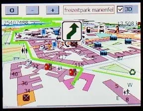 Students go on a GPS scavenger huntCopyright Erik Streb. Wikimedia Commons http://commons.wikimedia.org/wiki/File:Gosmore_in_berlin_with_winCE_on_transonic_6000.jpg
Students go on a GPS scavenger hunt. They use GPS receivers to find designated waypoints and report back on what they found. They compute distances between waypoints based on the latitude and longitude, and compare with the distance the receiver finds.
GPS has applications on land, at sea and in the air. Engineer-designed GPS navigation systems are used at sea by recreational boaters, commercial fisherman, cruise lines and shippers. In land-based vehicles, GPS systems show the vehicle's position on a street map so drivers can keep track of where they are, suggest the best route to reach a certain location, and aid in obtaining emergency roadside assistance by transmitting the vehicle's current position to a dispatch center. In the skies, GPS is used by all types of aircraft.
After this activity, students should be able to:
- Use numbers to count, measure, label, and indicate distances on a GPS receiver,
- Measure and calculate values from acquired data,
- Understand the connections between GPS technology and navigation, aircraft, and many forms of transportation
- 7.1.2.c Solve real-world and mathematical problems involving the four operations with rational numbers.
Grade 7
Do you agree with this alignment?
- Describe methods and equipment used to explore the solar system and beyond
Grade 8
Do you agree with this alignment?
- CCSS.Math.Content.6.NS.B.3 Fluently add, subtract, multiply, and divide multi-digit decimals using the standard algorithm for each operation.
Grade 6
Do you agree with this alignment?
- Information and communication systems allow information to be transferred from human to human, human to machine, and machine to human.
Grades 6-8
Do you agree with this alignment?
Each group should have:
- GPS Receiver
- 1 copy of the Explorers Worksheet
GPS receivers are becoming standard equipment for outdoor enthusiasts of all ages. It is not uncommon to find GPS in watches or in cars. They can be used for very serious purposes and also simply for fun. Did you ever go on a scavenger hunt when you were younger? In a group, you might have been instructed to search for items on a list. You frantically hurried from house to house in your neighborhood searching for those items, hoping you beat other groups in the hunt. The group that got back to the starting house first with all of the items was crowned the official scavenger hunt winner. At that time, you likely had no idea that in a few short years, technology would be developed by engineers that would allow you to use latitude and longitude for a scavenger hunt. Did you ever dream that you could be told that you would find objects at each point of an M if you followed the drawing of an M with a GPS receiver? It is possible. In this activity, you will have you own GPS scavenger hunt and try to find pre-specified locations using a GPS receiver.
Background
This activity was conducted on the University of Colorado at Boulder campus with several student groups. A list of campus waypoints — usually for points of interest like the library, the planetarium, student center, etc. — were entered into a set of receivers. Although the activity is not difficult, it takes students quite a while to get to the different waypoints and back to the central meeting location. Students really like the idea of using the GPS to get to a final destination and then finding their way back. Finding more difficult points — that have buildings or other obstacles in between — can make this activity more challenging.
Before the Activity
This activity requires a considerable amount of preparation by the teacher or the ION volunteer. You will have to select some interesting waypoints for the students to find, and enter them into at least one of the receivers. (Note: You can use EasyGPS® software to upload the waypoints from one receiver to other receivers. It can be tedious and time consuming to reset and load each of the receivers.) Try to pick some waypoints that have a clear view of the sky and others where visibility might not be so great. Make sure that the waypoint are a reasonable distance from your central meeting location and that students have enough time to make it there and back. Also, it is advantageous to pick some waypoints that take a direct path from one to the other and others that have a building or other obstacle in the way.
This activity is dependent on the GPS Receiver Basics activity (of Lesson 9). Student should complete that activity before doing this one.
With the Students
- Get students to begin thinking about the activity by asking them to brainstorm several uses for a GPS. (Possible Answers: navigating ships at sea, airplane landing systems, search and rescue operations, and even creating corn mazes.) Tell them that today, they will use the GPS for a scavenger hunt.
- Give each student group a worksheet to follow along with the activity and a receiver with the preloaded waypoints.
- Students should list the satellite numbers from which they are receiving transmissions and their starting point latitude and longitude readings from their receiver.
- Assign groups to find one or more of the preloaded waypoints. They are to report back on what they find at the waypoint (i.e., a specific building, a tree, etc.).
- Students should take notes on the directions given by their receiver. Are the directions accurate? What happens if you get off track? Does the receiver redirect you properly to the waypoint? Was it easy to find the object or location?
- Use the trace back to get directions back to your starting location. How does this compare with the directions to a location you had not been to previously?
- As students finish, have them work with another group to check the accuracy of their worksheet. Discuss worksheets as a class.
Pre-Activity Assessment
Brainstorming: In small groups, have the students engage in open discussion. Remind students that no idea or suggestion is "silly." All ideas should be respectfully heard. Ask the students:
- How is GPS used? (Possible answers: finding way when lost, navigation systems in a car, writing name in a field, creating corn mazes, for search and rescue, for ships at sea, etc.)
Activity Embedded Assessment
Worksheet: Have students complete the Explorers Worksheet.
Post-Activity Assessment
Pairs Check: After students finish working individually on worksheets, have them compare answers with a peer, giving all students time to finish the worksheet. Discuss as a class.
It is a good idea to send an adult along with each group of students if the locations are far apart or a substantial distance from your central meeting location.
Remind students to be careful when using the GPS receivers so as to not cause any damage or loss (especially with borrowed GPS receivers).
Make sure to check battery levels before embarking on the scavenger hunt; to avoid activity interruption, provide student groups or chaperones with extra batteries.
Another activity option for groups who want more outdoor experience is to do a "geocaching" exercise. To geocache: have groups hide small objects and provide only the latitude and longitude of the object. The task is to find the cache, enter your name in a logbook, and, in some cases, replace the object. Some caches are just signs that you are supposed to find. There are a number of websites listed in the References section where you can enter your location to receive a list of nearby caches. Be careful that you use the same coordinates.
This is an excellent website that has lists of caches you can search by location, information on geocaching, and recommendations on GPS receivers. http://www.geocaching.com/
Link for a free software package for automating the upload of waypoints to your receiver. http://www.easygps.com/
- Plot Your Course - Navigation
- Where Is Here?
- How to be a Great Navigator!
- Navigating by the Numbers
- Accuracy, Precision and Errors in Navigation: Getting It Right!
- Topo Map Mania!
- Getting to the Point
- Navigational Techniques by Land, Sea, Air and Space
- Navigating at the Speed of Satellites
- GPS on the Move
- GPS Receiver Basics
- Making GPS Art: Draw It, Walk It, Log It, Display It!
- GPS Scavenger Hunt
- Not So Lost in Space
Contributors
Matt Lundberg; Penny Axelrad; Janet Yowell; Malinda Schaefer Zarske
Supporting Program
Integrated Teaching and Learning Program, College of Engineering, University of Colorado Boulder
Acknowledgements
The contents of this digital library curriculum were developed under a grant from the Satellite Division of the Institute of Navigation (www.ion.org) and National Science Foundation GK-12 grant no. 0338326.
Copyright
2004 by Regents of the University of Colorado.